In French Guiana, Suriname, and Brazil, the Maroni and Oyapock watersheds span vast territories, often difficult to access and sparsely instrumented. Space hydrology allows for the monitoring of these environments from space, complementing ground measurement stations to improve knowledge, monitoring, and integrated water resource management at a transboundary scale.
Satellite Rainfall Monitoring
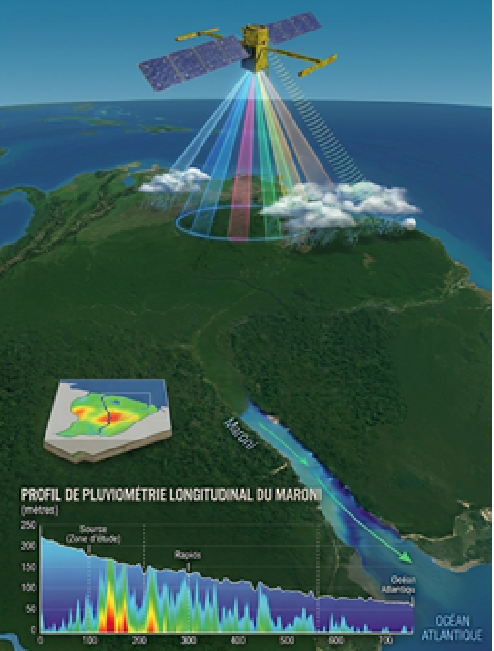
Algorithms retrieve satellite rainfall data provided by NASA for the Maroni and Oyapock basin areas and apply corrections using data from the CSG (Kourou) radar. This data feeds the hydrological model and helps better anticipate floods and droughts.
MGB Hydrological Modeling
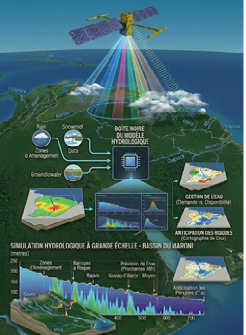
Powered by satellite data and in situ measurements, the MGB model daily simulates flow rates and water levels for both basins. It can also provide short-term forecasts, whose reliability depends on the quality of available weather forecasts. A key tool for water management and risk anticipation, with results accessible to support managers daily.
Space Altimetry
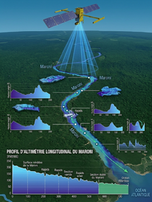
Satellites like SWOT measure the height of watercourses from space. A unique way to obtain water level data, even in the most isolated areas where no stations can be installed. This data complements field measurements and enriches hydrological knowledge of the two basins.
Water Color
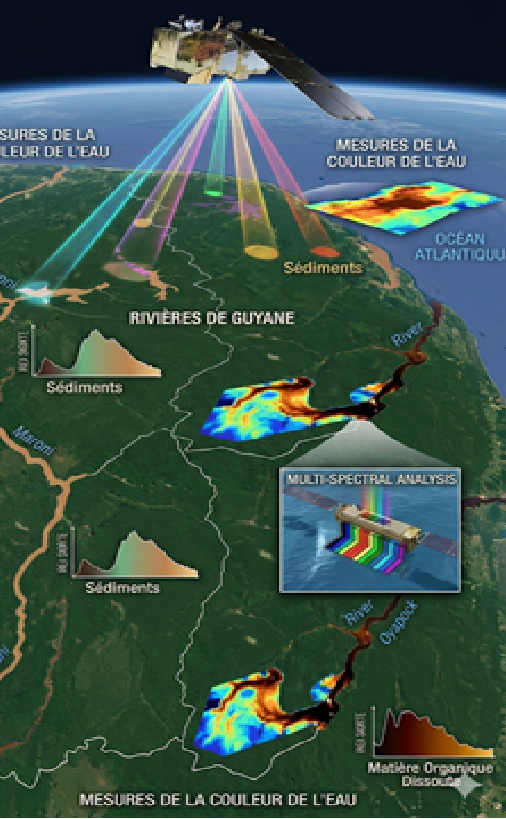
Processing Sentinel-2 satellite images via IRD/CNES algorithms allows for mapping surface water quality across 4 parameters: turbidity, chlorophyll, suspended matter, and organic matter. Valuable information for detecting pressures and monitoring the impacts of gold mining, agriculture, or seasonal variations.