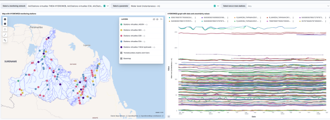
Spatial altimetry
Satellites like SWOT measure the height of watercourses from space. A unique way to obtain water level data, even in the most isolated areas where no stations can be installed. This data complements field measurements and enriches hydrological knowledge of the two basins.
HYDROWEB Theia, Jason, S3A, S3B, S6A monitoring stations data with uncertainty values
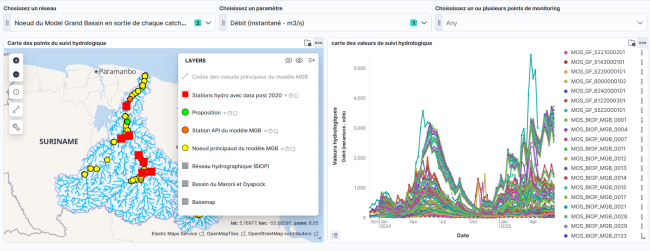
Hydrological data dashboard: in situ and MGB model
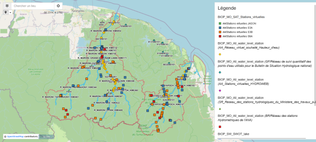
Map of in-situ water level monitoring points and spatial altimetry